Authorial London is a platform that allows users to explore the literary history of London through an interactive map complete with informational text boxes and photos. Developed by the Stanford Center for Interdisciplinary Digital Research, the project hopes to provide new insights into the importance of place in literature, as well as the historical evolution of places and their meanings. Here is a breakdown of how the program works:
Presentation
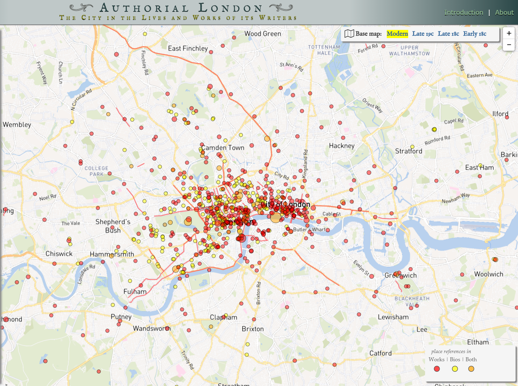
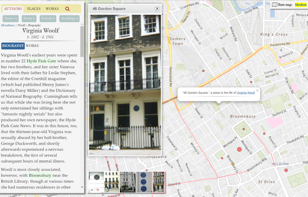
Authorial London is displayed as an interactive map with dots that mark important places in an author’s work or life. Each author has a brief biography, and photos are included for most places. Users can also explore the map through filters, including neighborhood, author, genre, form, time period, or the author’s social standing. This ability to look at multiple criteria makes the project appeal to a broad audience that includes readers, students, and researchers.
Services
In order to fill in the map, the creators first had to generate a list of place names from the primary sources. To do so, they combined automatic and manual methods. A preliminary reading of the texts provided an initial list of places, which they then used to search a broader, digital corpus. This search produced not only a longer list of places, but also the passages in which those place names occur. After placing this information in a database, the creators georeferenced each place through Google Maps and Nominatim (again, using a mix of automated and manual work). The map itself uses JavaScript technologies to integrate the place markers, biographical information, and photos.
Sources
The creators analyzed over 690 works by 47 authors, written during a period of over 500 years. These texts include novels, treatises, and poems, and they were accessed and searched through publicly available digital files on Project Gutenberg.
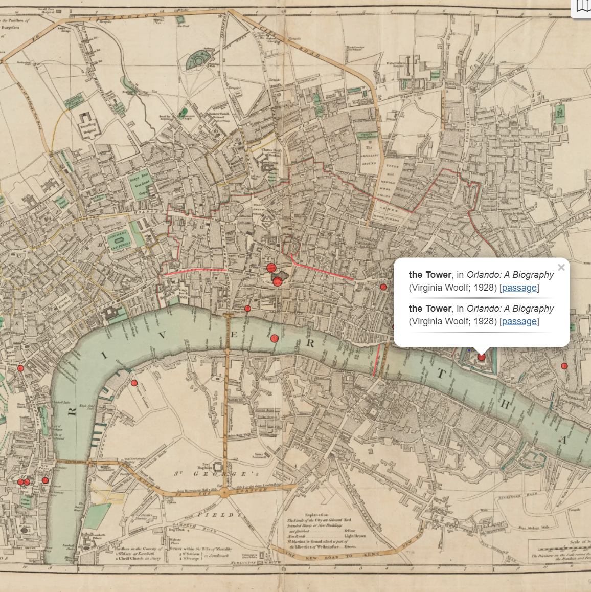
Another fascinating feature of the Authorial London project is the option to overlay the place data on historical maps of London. These maps were scanned from the Harvard College Library Digital Map Collection and “georectified” to fit the scale of the modern-day map.
Future Plans
The most exciting part of the Authorial London project is its potential to be reused and expanded. The creators of the project plan to add more authors to the map, and have set up the interface to make it easy to do so. They also plan to make the code behind the project publicly available so that scholars can replicate their design in cities across the world.
David, this is a really fascinating digital humanities project. It would be really interesting to see which authors’ locations overlapped and how that influenced their work. It would be cool to do use this resource to design a trip to London!
David, I really enjoyed reading about this project! Back when I was a freshman, my A&I focused on the significance of place to one’s sense of self and identity, so I found myself reminded of the fascinating conversations I had in that class as I was reading your post! I’m very interested to see where this project goes moving forward!